Saturday, September 27, 2014

China 1945

This map is shows the extent of Imperial Japanese occupation of China in 1940:


Enlarged into Preview, it shows clearly a great deal of the geography we need to get straight.

Reference points for our story include:

1.  Ledo, Myitkyina, and the Burma-China border;

2.  Yunnan Province, where I am guessing Gene is at a KMT HQ not too far from the border, at this point in the photographic series;

3.  Kunming, big trading city with a lake and a canal, and as you can see here, a rail line from Indo-China;

4.  Sichuan Province, where they like hot peppers in their food, with Chongqing, where Chiang Kai-shek established the provisional capital of Free China, the Japanese having occupied most of the other major cities;

5.  Shaanxi Province, containing Hsian ( = Xi'an,) claimed to be the oldest city in China, and where, soon in our story in the summer of 1945, OSS Detachment 202 will set up a field base;

6.  A rail line, running east-west, north of Hsian.  

That rail line crosses the Yellow River ( = Hwang-Ho.)  The double-track rail bridge over the Yellow River is vitally useful to the Imperial Japanese Army.

So now I will give the story away.  OSS Detachment 202 will deploy Team Jackal out of Hsian to blow up that bridge - indeed, to blow up three bridges in that area simultaneously.  Private Eugene Zdrojewski will be a member of that Team.

Two thousand Imperial Japanese troops will be on a train on the Yellow River Bridge when it blows.



Wednesday, September 24, 2014

Links Roundup: Calcutta to Ledo; Naga and Burma Tribes

One soldier whose story is up on China - Burma - India is Jack Thomas, who was in the 191st Signal Repair Company, stationed in Ledo in 1945.  One set of photos features Ledo and scenes of convoy from Calcutta to Dibrougarh to Ledo.  Here are a few:

Jack Thomas's photo of Dibrougarh in 1945.

Jack Thomas gave this the caption:
"Typical Naga tribesmen."

Jack Thomas's photo of Burmese girl
in Ledo, 1945.

Jack Thomas's photo: Ledo, 1945.


Walter Orey, an aviation engineer, built airstrips in Burma just a few months before Gene's group arrived.  We've referenced his memoir in an earlier post.  This section of his memoir describes the Kachin and the Shan:

"No country of its size had a greater variety of tribal and racial groups than Burma. More than a hundred languages and dialects were spoken in Burma. The two tribal groups that we became most familiar with were the Kachins and the Shans. The Kachins lived in the higher elevations of northern Burma. They lived by cultivating rice and they traded with the Shans. The Shans lived in settlements along river valleys in northern Burma. The Kachins were smiling hill people who were very friendly to the Americans. They helped the Americans because they expected that once the Japanese had been cleared out they would be able to live their lives as before. Some Kachins irregulars had assisted with the capture of Myitkyina and Kachin guerrilla forces worked with the Office of Strategic Services (OSS) behind the Japanese lines. Hundreds of redbrick pagodas and shrines, were scattered on the low lands along the Irrawaddy River. They always seemed more fascinating from a distance then when they were seen close-up. We were told that Buddhists had constructed the temples and shrines many centuries ago. An unusual sight for us was watching the Burmese women puffing on huge cigars, made of tobacco leaves and stems, and rolled in the cornhusks and tied with thread. They called these oversized cigars "cheroots." Most of the civilian homes and buildings in Myitkyina were destroyed in the battle to capture the town. Replacing them was a problem easily solved. Most homes were made of woven bamboo. It was not difficult to harvest an inexhaustible supply of bamboo from the jungle. The 1891st Engineer Aviation Battalion had constructed two airfields in northern Burma from October 1944 to March 1945."


He drove in the first convoy, 1,000 miles from Bhamo, Burma, to Kunming, seeing on the way returning Chinese who had been trained - presumeably to fight and to conduct sabotage operations agains Japanese supply and communications lines - in Assam:

 "The steepness of the grades and the thousands of hairpin curves were the causes of the convoy moving so slowly. We averaged less than 90 miles a day. Now and then we would see Chinese soldiers who had been trained in India, fought in Burma, and were now returning to China on foot."


LIFE Magazine published on the first convoy on the Ledo Road, with photos by Jack Wilkes.

The map below is one of several excellent maps in a highly-recommended overview essay on Warren Weidenburger's CBI site:


The pictures coming up next in the Zdrojewski collection look like China, but include people of various hill tribes.  Perhaps they had a camp inside China but near the Burma border, well to the west of Kunming, which was and is a big city.

We know how Dad traveled back over the hump at the end of the war: we have the color film footage from the transport plane, and we have a story about how the Japanese kept shooting at them.

How did he travel east over the hump into China?  Wouldn't his group have taken a truck convoy or a transport plane?  There are no photos in the collection to give us a clue.  But we do have two stories, heard in childhood.

One was about "riding a Chinese pony through Burma."  It started stumbling and generally acting distressed.  Gene dismounted and removed the saddle and blanket, to reveal a great big fresh saddle sore.  There was not a great deal he could do right away to help the animal, and his own distress at that was evident right there in the Marilla kitchen in the 1960s.

Another story was about "a Chinese pony stepped on my foot, and that is why the nail looks wrong and always will."

He never mentioned mules or horses; it was always "a Chinese pony."


Z

Tuesday, September 23, 2014

OSS CBI Photobook 11, Part 2 - Calcutta, and Transition to Camp, continued


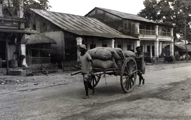
In the bottom half of this page, below, we examine the photos on the assumption that they are placed  in deliberate order, as I always do first.  Top row, left to right: B-24 bomber; cart in rural area drawn by a Chinese-style horse; big city.

But the B-24 and the big city are from one roll of film, I infer from the yellow tinge to the prints.  The other five are from another roll of film, with no yellow tinge.

So one hypothesis is that these big-deal OSS guys got a plane, instead of a train, from Calcutta to a rest camp to the northeast, in the direction of the hard-won trailhead of the Stillwell Road: Ledo.


Consolidated B-24 Liberator bomber,
identified for us by kind friends.

This is to the northeast: high, rural Assam or Nagaland.


So where could this rest camp be?
          Nagaland: Kohima?
          Assam: Dibrugarh, on the Brahmaputra River?
          Nagaland: Ledo itself?

That's a big ol' camera
in his buddy's right hand.
Kind friends have helped identify
it as a Graflex Speed Graphic.

Note the dagger and the wristwatch,
both standard in the OSS kit.
This is Frenchie, Albert Robichaud.

Here's Dad with one of the cameras we saw
him using in Washington, D.C., in November 1944.
It is a Graflex Speed Graphic,
model "Anniversary."

Besides the dogtags and the bracelet,
we still have that wristwatch.


So, dear friends, if you know someone who has been through something big, talk with them and get the details while you can.

Z


Monday, September 22, 2014

OSS CBI Photobook 11, Part 1 - Calcutta, and Transition to Camp

Page 11 of the Photobook transitions from
further Calcutta scenes, to air transport,
to a base camp somewhere.


Page 11, top half.

Gene sits in the center of this trio.
Note the insignia on his left shoulder.


I'm sure he liked the reflected image on the shiny paint
on the side of the bus, plus the contrasting modes of transport.
Persuasive ad: "Be Tailored at Kamalalaya Ld."

Note the coconuts at the lower left.

Can someone identify this gate?
What is that critter on the top?

Pretty long snout for a lioness.